Kyushu7 min read
Kyushu by Car: The Great Volcano Road Trip
A Kyushu road trip itinerary by car built around volcanoes — Aso's live crater, Kirishima's steaming falls, Unzen, and the Beppu-Yufuin onsen country.
Best time: Spring–autumn (avoid typhoon Aug–Sep)
Kyushu is Japan's most volcanic island, and the best way to feel it is from behind the wheel. This Kyushu road trip itinerary by car strings together the volcanoes that define the island — the world's rarest walk-up crater at Aso, a hot-spring waterfall in Kirishima, the eruption-carved Shimabara Peninsula below Mount Unzen, and the steaming onsen country around Yufuin and Beppu. Trains reach the big towns, but the grassland caldera roads, roadside cinder cones, and lakeside baths in between only open up if you drive. Rent a car in Fukuoka or Kumamoto and loop it clockwise: down onto the Aso caldera floor, south toward Kirishima, west to the Shimabara coast, then northeast into the Yufu-Beppu geothermal belt before circling home. Every stop below is a real, verifiable place — no invented "scenic overlooks" — with the driving legs and fees you actually need. Go between spring and autumn, and steer clear of the August–September typhoon window.
01Kumamoto
Naka-dake Crater (Mount Aso Active Crater)
中岳火口
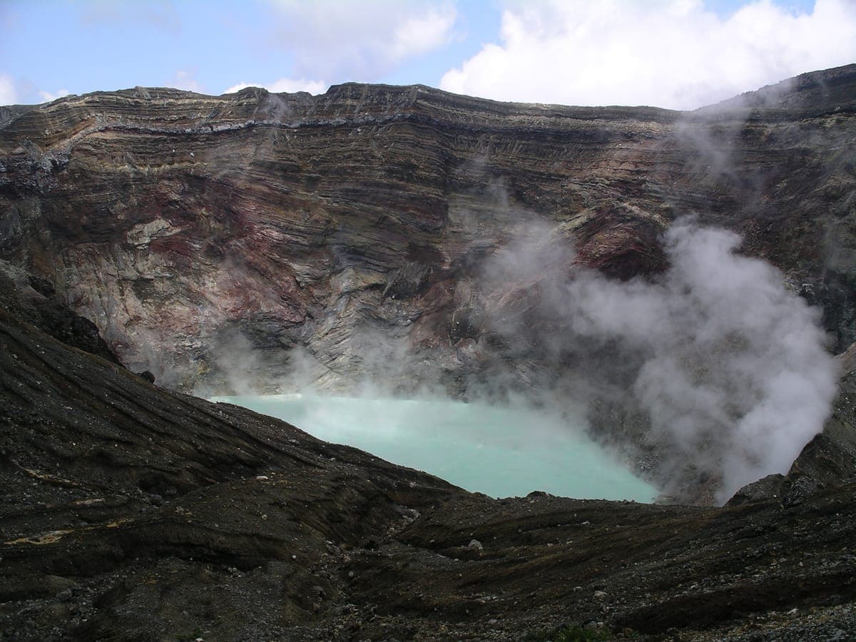
Naka-dake is the beating heart of the Aso caldera and the reason most travelers detour here at all. It is one of the very few volcanic craters on Earth the public can approach on foot or by shuttle to peer directly down into an emerald, steaming acid lake. Gas levels are monitored continuously, and the rim comes fitted with concrete blast shelters, a lookout terrace, and a small shrine — a vivid reminder you are standing on something alive. Access is intermittently suspended whenever gas or alert levels rise, so always check same-day status before you set out.
Getting there: Drive to the Aso Volcano Museum / Kusasenri area (about 30 minutes from JR Aso Station), then transfer to the shuttle bus up to the crater-top terminal. Crater shuttle ¥800 adult one-way; access is frequently suspended for volcanic safety, so confirm it is open that morning. Best year-round.
02Kumamotohidden gem
Komezuka
米塚
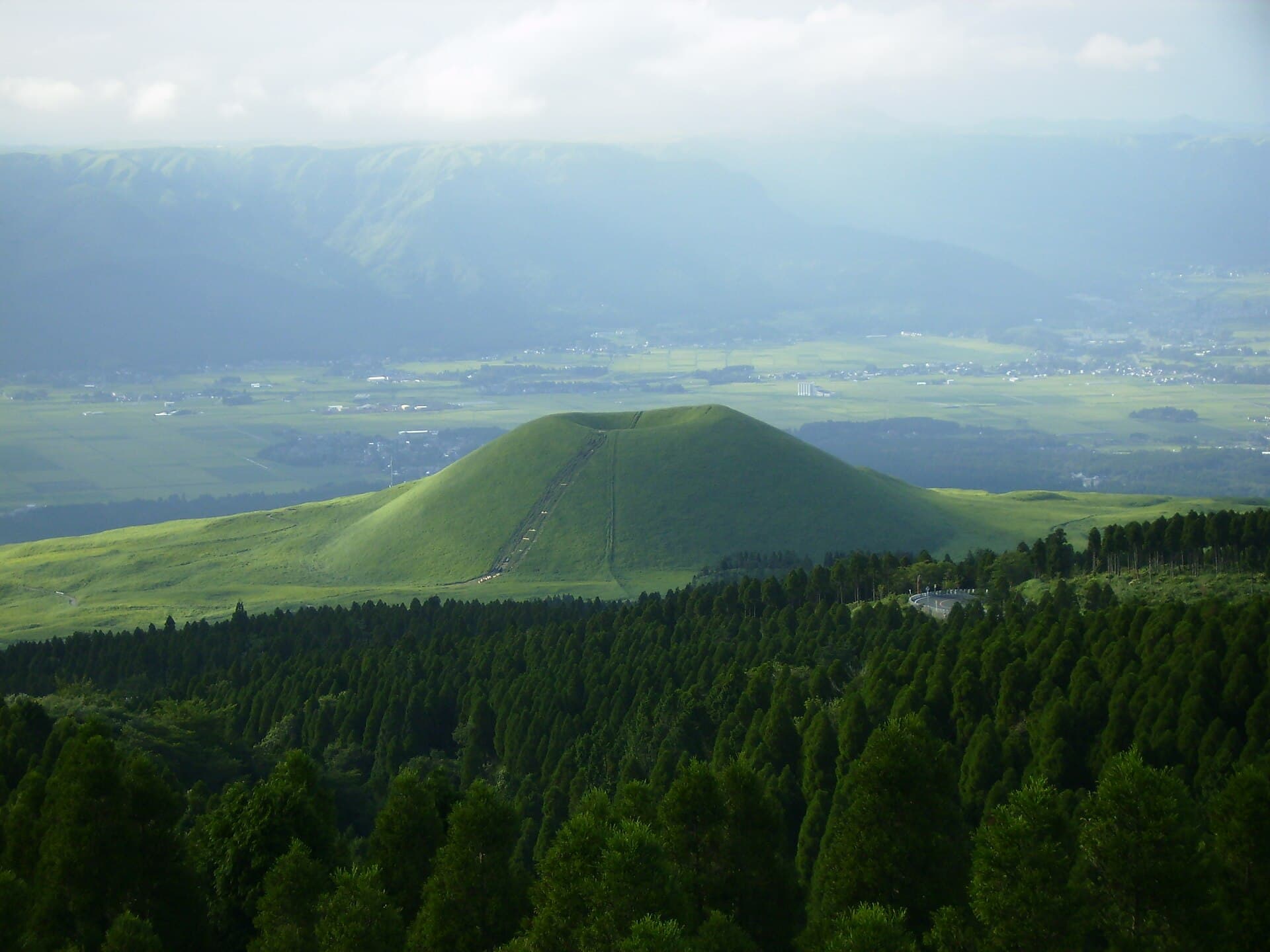
A few minutes down the Aso Milk Road from Kusasenri sits Komezuka, an almost perfectly symmetrical grass-covered scoria cone about 80 meters tall, formed by a strombolian eruption roughly 3,300 years ago. Its name — "rice mound" — comes from a legend that the Aso Shrine deity once scooped rice from its indented crater to feed the poor. It is a textbook volcanic landform that appears on nearly every Aso postcard, and the perfect low-effort drive-by anchor between crater and grassland.
Getting there: Roadside viewing area and small parking lot on the Aso Milk Road (Prefectural Route 111) between Kusasenri and Aso city, about 20 minutes by car from JR Aso Station. Climbing the cone itself is prohibited for conservation.
03Kumamotohidden gem
Kijimadake
杵島岳
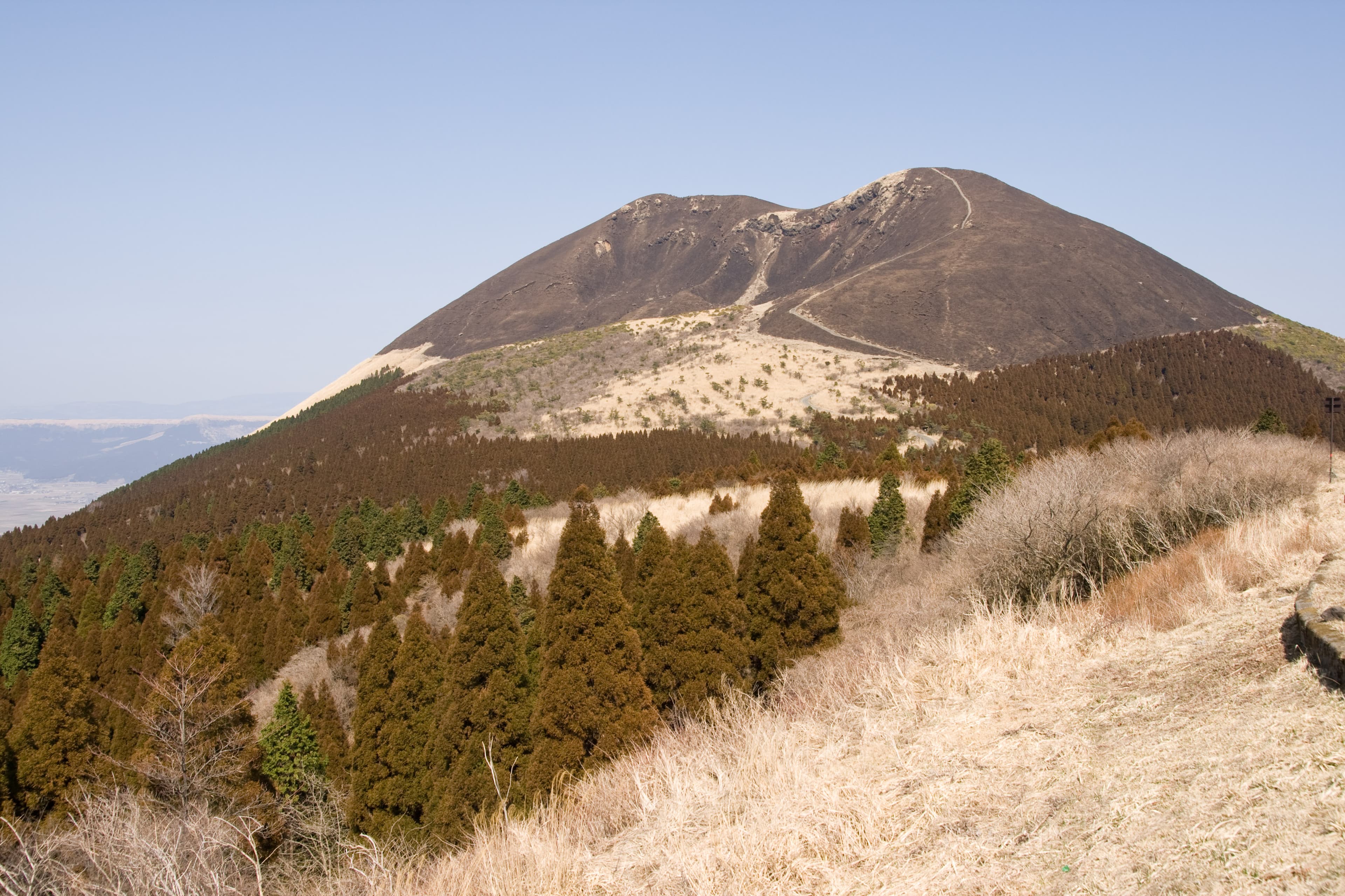
If you want to actually stand on a volcano without the crowds or the gas advisories, Kijimadake is the one. A grass-covered basalt cone formed around 3,500 years ago, it is the most accessible of the Aso Five Peaks: a paved, well-maintained trail from the Kusasenri parking area reaches the summit crater rim in about 35–40 minutes. The summit loop circles an old crater and delivers direct views east into the active Naka-dake area and down over the Kusasenri grassland — a genuine beginner volcano hike that most guides bury under Naka-dake's ropeway.
Getting there: Trailhead is right at the Kusasenri parking area; roughly 26 minutes by Sanko Bus from JR Aso Station to the Kusasenri stop, then about 40 minutes on foot to the summit. The trail is free; the Kusasenri / Aso Volcano Museum lot charges a car fee (~¥500).
04Kumamotohidden gem
Nekodake
根子岳
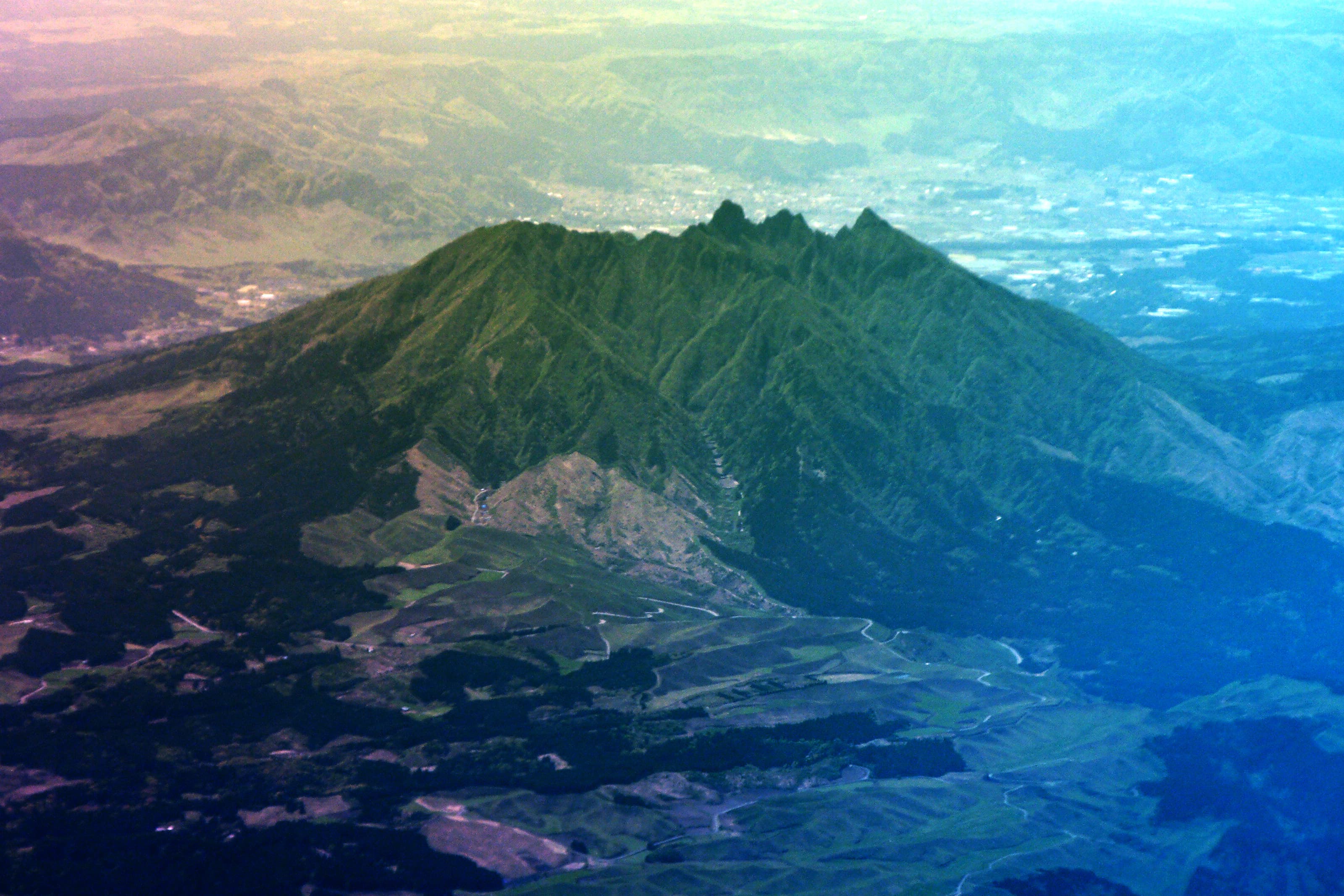
Look east across the caldera and one silhouette breaks the pattern of smooth cones: Nekodake, the jagged, twin-peaked member of the Aso Five Peaks, rising to 1,433 meters at Tengu-mine. Its serrated ridgeline was carved by heavy erosion of an older andesite stratovolcano, and from the caldera floor it resembles two cat ears — hence the name ("neko" = cat). Most visitors only photograph it from Komezuka or Daikanbo; climbing it is a legitimate, moderately technical day hike with sweeping caldera views and none of Naka-dake's crowds.
Getting there: No direct bus to the trailhead — access by car or taxi, about 40–50 minutes from JR Aso Station to the Aso City-side trailhead. Note that as of 2026 the Takamori-side routes remain closed for safety; only the Hakoishi-Tsuruioone route from the Aso City side is open. Free trail access.
05Kagoshimahidden gem
Maruo Falls
丸尾の滝
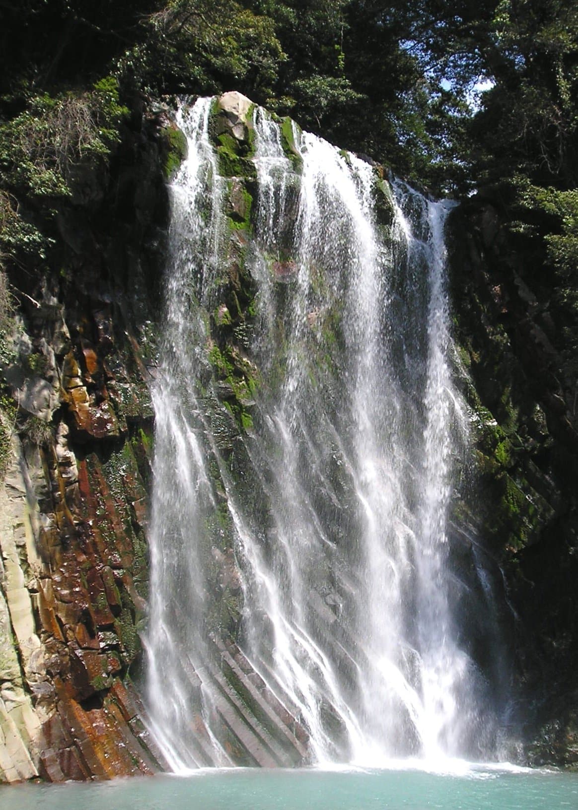
Turn south and the road eventually delivers you to Kirishima, Kyushu's other great volcanic complex, where the standout curiosity is Maruo Falls — a rare "hot-spring waterfall." Fed by four upstream hot springs, the 23-meter cascade actually runs warm and visibly steams in winter, tumbling right beside the road between Maruo Onsen and Kirishima Shrine. It is the kind of only-in-Kirishima sight most visitors blow past on their way somewhere else.
Getting there: On Route 223 with a viewing platform and parking beside it; about 40 minutes total by bus from Kirishima-Jingū Station, or drive straight to the roadside lot. Free roadside viewing platform.
Shimabara Peninsula
Swing west toward Nagasaki and the land itself tells the volcano story. The Shimabara Peninsula was formed by the eruptions of Mount Unzen, and its coastline, hot springs, and lava-shaped terrain make it one of Kyushu's most scenic and culturally rich corners — layered with history from the Shimabara Rebellion. Most travelers funnel toward Nagasaki city and overlook it entirely, which is exactly why it stays quiet.
Getting there: From Hakata Station it is about 2 hours 46 minutes by car via the Nagasaki Expressway; also reachable by train and bus from Nagasaki City. Best in spring and autumn.
06Oitahidden gem
Mt. Yufu Front Trailhead (Shomen Tozanguchi)
由布岳正面登山口
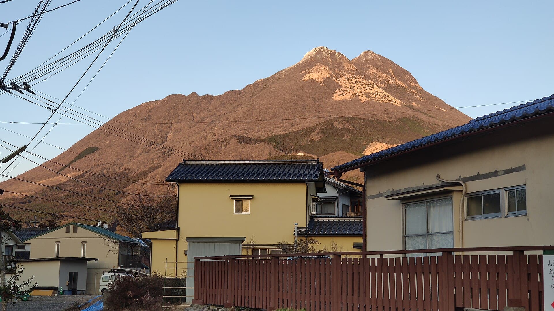
Now point the car northeast into the Yufu-Beppu highlands. Mt. Yufu is a dormant twin-peaked volcano nicknamed the "Fuji of Oita" that towers over the Yufuin basin, and this front trailhead is the main way up its 1,583-meter summit. The path climbs through pastureland and broadleaf forest to a fork called Goyagoshi before splitting to the East and West peaks; reckon on a 4–5 hour round trip. It is the mountain behind nearly every Yufuin postcard — and a proper hike rather than just a photo backdrop.
Getting there: Drive along Route 11 toward Beppu, or take the Kamenoi Bus bound for Yufu-tozanguchi from Yufuin Station (about 20 minutes); free trailhead parking with toilets. Free public mountain trailhead. Best spring through autumn — avoid winter for ice and snow on the upper trail.
07Oitahidden gem
Yufuin
由布院
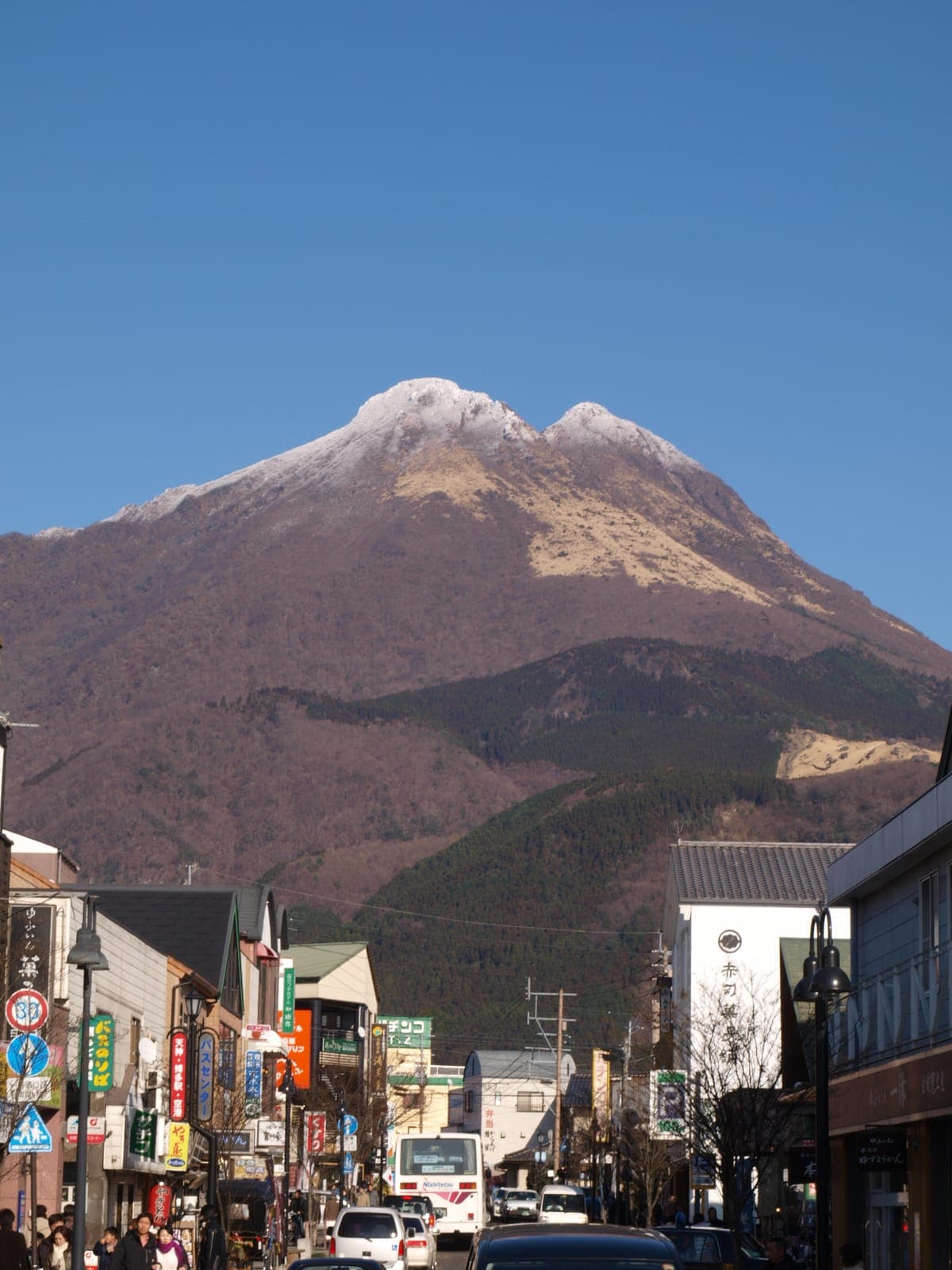
Park the car and slow down in Yufuin, where the backstreets are a network of narrow lanes filled with small art galleries, local crafts, and traditional ryokan beneath Mt. Yufu's twin peaks. The quiet showpiece is Lake Kinrinko, best in the early morning when mist rises off the water and wraps the whole town in an unreal calm. Most day-trippers cluster at the busier attractions, leaving these tranquil lanes to whoever wanders in.
Getting there: From Hakata Station it is about 1 hour 34 minutes by car; the backstreets are a short walk from Yufuin Station. The public shopping lanes (Yunotsubo Yokocho) and Lake Kinrinko are free — no admission ticket.
08Oitahidden gem
Beppu Beach Sand Bath (Shoningahama Sand SPA)
別府海浜砂湯(上人ヶ浜サンドスパ)
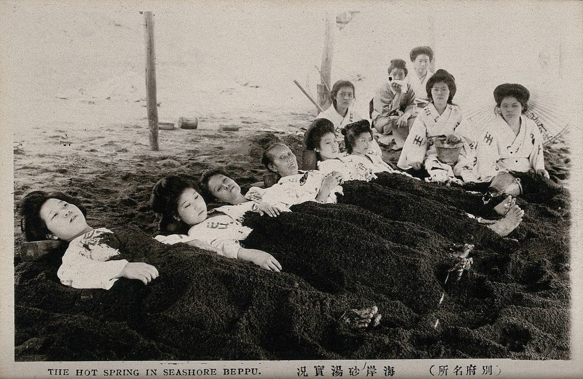
Close the loop in Beppu, Japan's geothermal capital, with a bath you can only get where the ground runs hot. On the Shoningahama waterfront inside Shonin Park, attendants bury you in naturally geothermal-heated sand right on the beach, with Beppu Bay as the backdrop — the modern successor to the historic Beppu Kaihin Sunayu on the same site. It is a coastal onsen experience entirely distinct from Beppu's inland bathhouses and hell districts, and it is especially good at sunset.
Getting there: Kamenoi Bus from Beppu Station toward Shoningahama, about 20–25 minutes. Admission ¥2,500 (sand bath bundled with the grand bath). Best year-round, especially pleasant at sunset.
When to go
Volcano country is a spring-through-autumn drive. Aim for April–June or October–November: the caldera grasslands are green, the mountain trails on Kijimadake, Nekodake, and Mt. Yufu are clear of ice, and the roads are at their most scenic. Avoid the August–September typhoon window, when heavy rain closes mountain routes and grounds boats and shuttles. Winter has its own reward — Maruo Falls and the Beppu sand bath both steam most dramatically in the cold — but check for snow and ice on the higher trailheads before committing. One rule overrides the calendar: Naka-dake's crater access is suspended without warning whenever volcanic gas rises, so always verify same-day status before driving up.
Keep exploring
- Kyushu Onsen Towns Nobody Knows — go deeper into the geothermal side of this route.
- Kagoshima & Miyazaki: The Deep South — extend the loop past Kirishima toward Sakurajima and the Osumi coast.
- Nagasaki Hidden Heritage — pair the Shimabara Peninsula with the wider Nagasaki story.
Ready to plan? Build your own hidden-Japan itinerary → — our trip generator turns any of these spots into a day-by-day route.